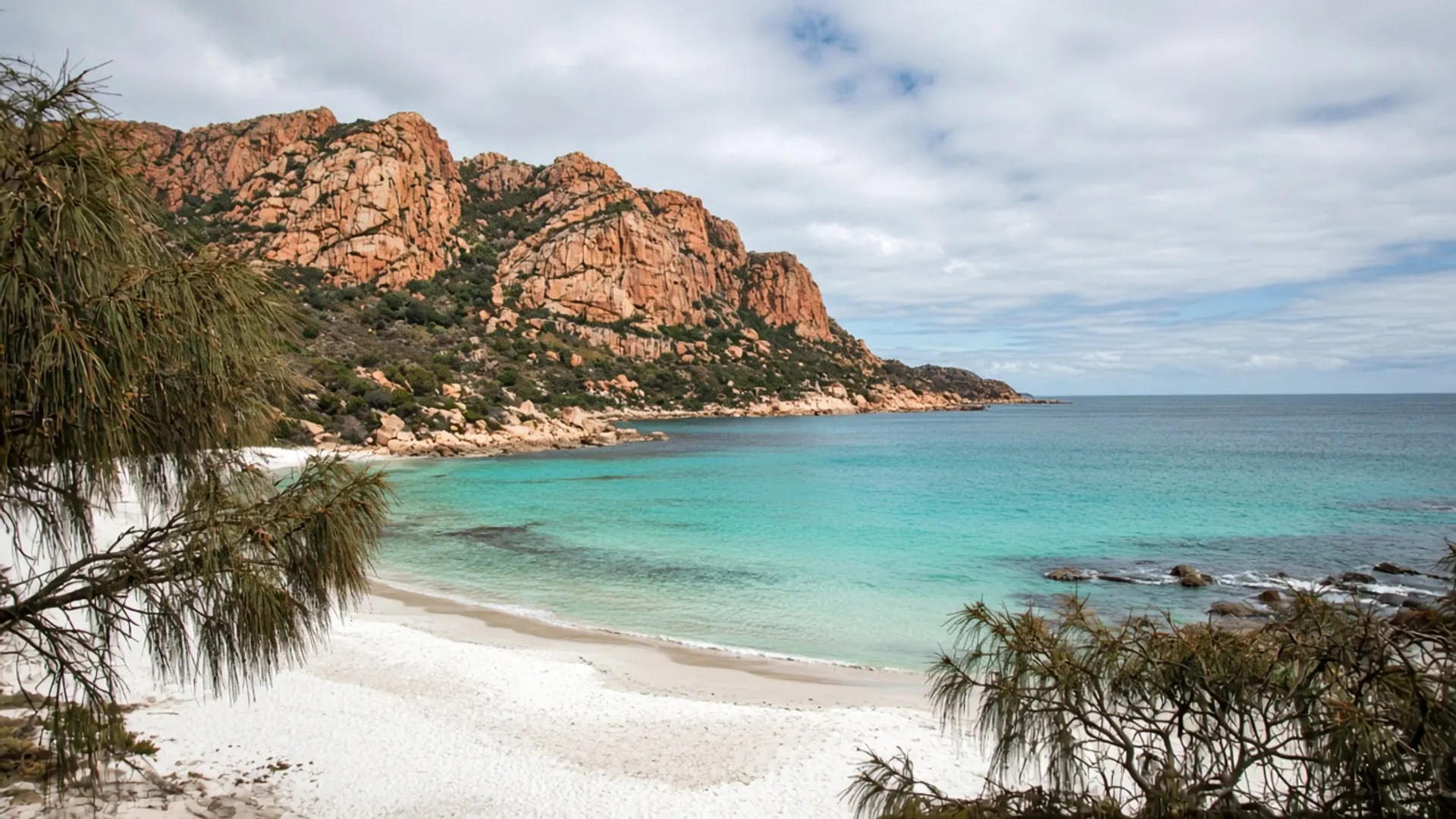
Start the Bay of Fires at Binalong Bay unless you already know why you are driving further north. It is the township and the usual sealed arrival from St Helens: pale coves, granite with orange lichen, a small street, and immediate access to the Bay of Fires Conservation Area. The rest of the coast toward Eddystone Point is a longer, sometimes unsealed, sometimes 4WD conversation. Most visitors should collect the southern granite well and go home in daylight.
This is a gateway page. The landscape essay sits on Bay of Fires.
A township on the north-east granite
Binalong Bay is small even by east-coast standards. St Helens, a short drive inland and south, is the service town — fuel, shops, the ordinary machinery of a trip. Do not expect Binalong Bay to behave like Hobart or even like Bicheno. Confirm food hours; in winter they shrink, in January they strain.
The water is the Tasman / east-coast kind that photographs as turquoise when the wind is kind. It is still Tasmania. Swim with respect for swell and for the absence of a city lifeguard system. Beaches on this island change by coast; this is the north-east pale-sand version, not the west-coast driftwood version.
Palawa Country, again. Furneaux named the wider bay in 1773 after fires already burning on the shore. The township is a later, thin settlement on that coast.
Council roads and Parks reserves interleave. Read the sign at the car park you use. Conservation-area rules on camping, fires, dogs and drones are not optional, and they are not the same sentence as a national-parks pass. If you continue into Mount William National Park, a parks pass does apply. Check the official map.
Gateway, not the whole coast
From the township you can walk onto granite without a expedition plan. That is the point of a gateway. Picnic areas fill on warm weekends. Lichen scuffs when people climb every boulder; don’t.
North along the conservation area the character stretches: longer beaches, fewer toilets, more chance of unsealed access. That is where 4WD language starts to be real, and where hire-car contracts often already said no. Tide and soft sand are not a personality test. If you do not have the vehicle and the current Parks note, stay with the sealed-end coves.
Boobyalla Beach and Cape Portland are other north-east water, remoter, windier, not interchangeable with Binalong Bay’s lichen stage. Bridport is a different north-east town on Anderson Bay.
How it sits in an east-coast week
Freycinet and Wineglass Bay are south. A three-day east-coast itinerary that is honest about the lookout walk should not also “pop up” to Binalong Bay unless you have added a night. The Tasman Highway is pretty. It is also slow behind caravans and wildlife.
A north-east-weighted week from Launceston can reach Binalong Bay more naturally, sometimes via inland country near the Blue Tier or the Fingal Valley and Avoca. Still give the coast its own day. Still check Parks and council alerts in fire season.
Beds in Binalong Bay and St Helens are a live market. We quote no rates. Historical lodging names — including Coles Bay’s BIG4 Iluka — are historical listings, details unverified, and they are the wrong town anyway.
Guided days that include Bay of Fires from Hobart are long. Read tours. Self-drive from St Helens is the version that matches the geography.
Season and manners
Summer is the crowded water. Autumn is often the calmer swimming and walking window — when to visit. Winter is empty granite and short light. Spring is wind.
Take rubbish. Stay off dunes where they are fragile. Do not cut firewood. Wildlife is not a guaranteed show; penguins belong to other east-coast paragraphs with their own ethics.
Then stand on the granite you can reach without a recovery strap, and let the rest of the Bay of Fires remain a coastline rather than a checklist. About Tasmania is the reserved-land frame if you need the island to make sense around this one cove.